The Scale Ranges dialog is accessed via a button in the right panel of the Layers window. It allows you to specify, based on the map view's scale, when a selected layer is displayed and/or labeled. It's applicable to any kind of layer, except that the controls for labeling are only enabled for non-images.
Note that by entering a smaller number in an edit box, you would be specifying a larger scale (or corresponding zoom percentage) for the transition from labels to no labels. When setting this up you can use as a guide the current map scale that's reported in the dialog:
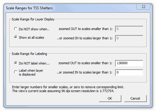
Often, when scale ranges are specified for a shapefile, the Symbols dialog will have a gray check mark in the "Use Labels" box at the top. This means that the "Toggle label display" button in the program's toolbar will have no effect on label display for this particular layer. It will be controlled only by scale range. For point shapefiles the situation is the same for marker display.
Scale range settings can also be applied to an entire folder of layers. If this dialog is invoked when a folder is selected in the Layers window, its settings are initialized to those of the first (topmost) layer in the branch. If you then select OK, with or without further adjustments, the settings will be applied to all layers in the branch and the map view will be updated as necessary.