Like a point shapefile, polygon and polyline shapefiles also have a Symbols dialog for controlling appearance, one that's accessed via the same button in the Layers Window's right panel. Some of the controls are the same or similar to those in the corresponding dialog for point features. One significant difference is the lack of predefined text search fields. That's because only point features are candidates for the Selected Points window, even though text searches are supported for all shapefiles in table views. Another difference is that this dialog has separate fill and outline opacity settings for polygons. Finally, while markers for points always have smooth outlines, there's an Antialiasing option for the lines and edges that you'll normally want to enable. Upon layer addition it's disabled.
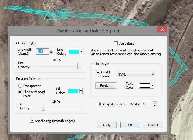
The spatial indexing checkbox was recently added to the Symbols dialog for polygon shapefiles. When enabled, the index won't be used for simply displaying the shapefile. It will instead be used for determining which polygon contains a specific point, such as when initializing field values that depend on location. The speed-up is dramatic when a large shapefile is used to initialize thousands of records during an export or database update. I suggest leaving the index "depth" option set at 5.